Rissland
| The Commonhold of Rissland Die Gemeinschaft Rissland Héndhldeh Hromanom | |
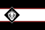
| Flag | Coat of arms |
|---|---|

|
[[File:|150px]] |
| Motto: | |
| Anthem: | |
| Locator map | |

| |
| Capital city | Fügung |
| Largest city | |
| Official language | Stoldish |
| Other languages | Eokoesr |
| Ethnic group | |
| Religion | Revisionist Dlroch'veldr, Stellist Orkanan, Irreligion |
| Demonym(s) | Risslandish, Risslander |
| Government | |
| Government Type | Orderist technocratic federal subject |
| Oberhauptführer | |
| Your 2nd leader title (e.g. Prime minister) | name |
| Legislature | Gründerrat |
| Establishment | |
| event 1 | date 1 |
| Area | |
| Population | |
| Economy | |
| Economy type | Orderist planned economy |
| Currency | Commonwealth Energy Certificate (GEA) () |
| Other information | |
| Driving side | right |
| Internet code | .soc |
Rissland, officially the Commonhold of Rissland (Stoldish: Gemeinschaft Rissland, Eokoesr: Héndhldeh Hromanom), is a country in Anaria.
History
- Main article: Dhonowlgos
Foundation
The foundation of the Riss starts with the invasion of Dhonowlgos during the Helreich-Wolgos War in 7456-7460. The accounts of the entire invasion is unclear as reports of the ordeal miss entire sections and angles to the conflict. At the start of the invasion, it is known that overwhelming air and naval forces overcame Wolgos forces of the island's southern shores. Beach landings progressed and a bitter fight for the island proceeded for the following 14 months. At the 14 month mark, records of the conflict become significantly patchy and incomplete. During this time, Wolgos forces broke their lines and ordered a full retreat and evacuation of the island. It is known that the population of Dhonowlgos before the conflict was roughly 12 million, but reports by the Bind report only 4.5 million were evacuated, another 4 million Wolgos perished while 3.5 million Eokoesr were freed.
At the end of the conflict, Häverist forces stopped near the east coast and halted their advance as the Wolgos took a last stand. Ferocity of the defenders at this point of the war have been told in stories by survivors of the war. At this stage, the Hellish navy blockaded the eastern coasts of the island and started bombarding the coast, all while maintaining a siege of the surrounding lands. With food supplies being cut off or destroyed, the remaining Wolgos lasted 6 months before food supplies ran out, leaving the remaining Wolgos too weak to be effective in combat. No surrender was made by the Wolgos. All lands gained by the Häverists were now firmly under their control and was further on known by the name, the Riss, which in Stoldish means "the fissure".
Under the orders of the newly created Stolvic Häverist Commonwealth, the lands of the Riss were to become a Commonhold within the Commonwealth. Direktors were then and on forward chosen to rule the colonists that brave the choice of settling of the lands of the Riss.
Emancipation of the Eokoesr
Geography
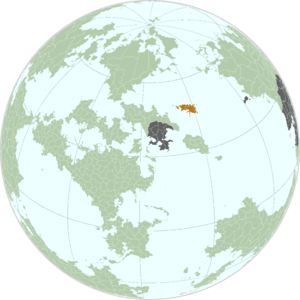
Rissland is made up of a single large island accompanied by a collection of smaller islands of various sizes and significance, the islands have a wide variety of topography with plains, a volcanic plain and a two mountain ranges dominating the landscape, the islands are also well known for their considerable volcanic activity. The highest point in Rissland is Mount Whlor at 3728 meters above sea level, the total land area of 333,696 km2.
The islands are also characterized by their peculiar coasts where cliffs with narrow stony beaches are the dominant feature, the cliffs are occasionally interrupted by collapses that have formed access inland and where Wolgos villages and cities grew to take advantage of the access to the sea, where accesses were not available villages have built wooden ladders to artificial piers and many other villages use the cliff as a source of gull for wine production. In some rare occasions towns have been built into the cliff faces were openings and passages have been carved into the cliff face. The average height of most cliffs ranges between 5-10 meters with occasional variations of up to 50 meters. The straights between the islands tend to be deep with depth dropping significantly after a few meters from the coast but unlike the stormy sea the straights have milder currents and shallower waves.
Inland the plains of the islands benefit from the rich volcanic soils and abundant rains brought by the Stolvic ocean and are some of the most fertile soils in Anaria although their productivity is subject to Tyrian oscillations, vast expanses have been turned into farmland but a significant proportion of land remains forested as virgin forests or managed wood plantations. The forests have significant religious and cultural value in the Orkanan religion but are also important for sustain the island's population during the coldest epoch of the Tyrian oscillations where vast tracks of farmland become unsuitable for any activity other than pasturing sheep and reindeer.
The two mountain rangers are technically a single range that transverses the mainland but that is broken into by the rift valley, the rift valley is a long expanse with considerable geothermal and volcanic activity where the landscape is compromised of hilly volcanoes, barren ash expanses and open lava flows. Most volcanic activity is in the form of open lava flows and volcanic ash columns but rarely are pyroclastic explosions and flows seen which have allowed the area to be developed with minimal risk of significant destruction.