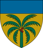
Negasi
| Negasi Republic Jamhuriyar Negasi (Negasi) | |
| Flag | Coat of arms |
|---|---|

|

|
| Motto: | |
| Anthem: | |
| Locator map | |
| [[File:|300px]] | |
| Capital city | Bogaye |
| Largest city | Elmisi |
| Official language | Negasi |
| Other languages | |
| Ethnic group | |
| Religion | Naskel, Anur |
| Demonym(s) | Negasi |
| Government | |
| Government Type | Unitary parliamentary semi-presidential republic |
| Grand Chief | Rakanja Sadaka |
| Superintendent | Ayubu Owethu |
| Legislature | Superior Council |
| Establishment | |
| Independence | January 30, 7663 |
| Area | |
| Total | 1,217,757.05 km2 |
| Water % | 4.39 |
| Population | |
| Total | 88,910,846 |
| Density | 73.01/km2 |
| Economy | |
| GDP (total) | Ꞡ 667.01 billion |
| GDP per capita | Ꞡ 7,614.49 |
| Currency | Negasi nauyi () |
| Other information | |
| Driving side | right |
| Internet code | .neg |
Negasi, officially the Negasi Republic (Negasi: Jamhuriyar Negasi), is a country predominantly in southwest Tharna with a portion in northwest Tzeraka. Its western boundary is the Vovodaran Sea and the Tanga Moji Sea lies to the country's east. The Ubani Canal links these two seas, forming a route for ocean-going vessels between the Ovestan and Phasian Oceans. The country has an area of 1,217,757 km2 (470,179 sq mi) with a population of 88,910,846.
History
Early history
Colonial period
The region was colonized by Auresia in the early 7400s, with the first records of the South Tharnan colony dating from October 5, 7407.
During the colonial period, the Ubani Canal was built. Construction began in 7563 and the canal opened to ship traffic on December 15, 7607 after some delays during the Great Scourge.
Post-colonial period
Rising anti-colonialism globally after the turn of the 77th century led to a rise in Negasi nationalism in the 7600s. The formation of the Open Seas Security Organisation (OSSO), with its purpose of fostering maritime trade, after the First Coalition War (7632-7634) underscored the importance of the canal for shipping and as a national resource. On the eve of the Second Coalition War, a general strike occurred across much of Negasi beginning on November 16, 7662. Among other effects, the strike shut down canal operations preventing transit between the Ovestian and Phasian Oceans. The strike led to Auresia granting Negasi its independence on January 30, 7663 in exchange for the restarting of canal operations and a promise to keep the canal open.
In 7672, Negasi expropriated the Ubani Canal from its foreign, private owners and nationalized it, placing it under the jurisdiction of the Ubani Canal Authority, a government corporation.
Geography
While predominantly located in Tharna, Negasi is astride the division between Tharna and Tzeraka, with a portion of the country's southwest located in the latter continent. The Vovodaran Sea lies to the west and the Tanga Moji Sea adjoins Negasi's east coast. The Koradium Mountains lie along a significant portion of Negasi's northwestern border. This region is home to three large lakes: Moto, Jelwa, and Tila. The Giganum Mountains are in the south. The Ubani Narrows lies between the two large mountain ranges.
The Oluwa Islands comprise a series of several islands off Negasi's west coast in the Vovodaran. There are several islands in the Tanga Moji, including Jabar, Set, Moriba, Salanko, M’basso, Torosso, Kolibelo, and Dyalinko islands.
Waterways
- Babukar River
- Ubani Canal
- Some other significant rivers (prolly 11 or 12 of them)
Climate
Negasi has a tropical wet climate along its western coastal region which large humid tropical areas inland. A band of tropical savanna wraps round a region of hot semi-arid grasslands in the east. A small area of oceanic climate lies north of the Giganum Mountains in the south center of the country.
Politics
The Negasi Republic is a unitary parliamentary semi-presidential republic. The head of state is the grand chief who is chosen by direct election to fill a five-year term. The superintendent is the head of government and is typically the leader of the majority party in the Superior Council, Negasi's parliament. The superintendent serves until removal through a vote of no confidence or another party becomes the majority party in the Superior Council.
All citizens aged 18 and over are entitled to vote in all elections. National elections for the grand chief take place every five years and annually for one-fifth (120) of the seats in the Superior Council. Superior councilors are elected on a proportional basis in fixed electoral districts. Each of the 600 superior councilors represents about 148,185 citizens.
Foreign relations
Military
The Negasi National Guard serves as the country's armed forces. It has a land guard, maritime guard, and an air service. The full-time professional force is relatively small but all citizens through age 30 are considered reserves and may be called up in the event of a national emergency.
Administrative divisions
Negasi is a unitary state, so its administrative divisions have limited authorities of their own. The first-level divisions are the four quadrants: Bakin-kogi, Tsaunuka, Tumkarik, and Masokudo. Each is overseen by a high chief and high council. Each quadrant has a number of kasashe (lit. lands) of which there are a total of 96. A chief and council preside over the functions of the kasa. Considered on an equal level, cities, towns, and villages represent local governance under the administration of their local chief and local council. The chiefs at each level are elected by their respective councils which are, in turn, directly elected by the constituents of their districts.