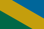
Negasi
| Negasi Republic Jamhuriyar Negasi (Negasi) | |
| Flag | Coat of arms |
|---|---|

|

|
| Motto: | |
| Anthem: | |
| Locator map | |
| [[File:|300px]] | |
| Capital city | Bogaye |
| Largest city | |
| Official language | Negasi |
| Other languages | |
| Ethnic group | |
| Religion | Naskel, Anur |
| Demonym(s) | Negasi |
| Government | |
| Government Type | Unitary parliamentary semi-presidential republic |
| Grand Chief | Rakanja Sadaka |
| Superintendent | Ayubu Owethu |
| Legislature | Superior Council |
| Establishment | |
| Area | |
| Total | 1,217,757.05 km2 |
| Water % | 4.39 |
| Population | |
| Total | 88,910,846 |
| Density | 73.01/km2 |
| Economy | |
| GDP (total) | Ꞡ 667.01 brillion |
| GDP per capita | Ꞡ 7,614.49 |
| Other information | |
| Driving side | right |
| Internet code | .neg |
Negasi, officially the Negasi Republic (Negasi: Jamhuriyar Negasi), is a country predominantly in southwest Thania with a portion in northwest Tzeraka. Its western boundary is the Vovodaran Sea and the Tanga Moji Sea lies to the country's east. The Ubani Canal links these two seas, forming a route for ocean-going vessels between the Ovestan and Phasian Oceans. The country has an area of 1,217,757 km2 (470,179 sq mi) with a population of 88,910,846.
History
The country was colonized for a while then it became independent and now it's today.