Chaska: Difference between revisions
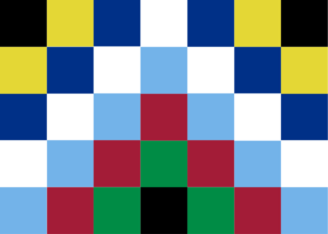
(Added the flag.) |
(Demographics.) |
||
| Line 25: | Line 25: | ||
|- | |- | ||
! Largest city | ! Largest city | ||
| | | [[Viracachá]] | ||
|- | |- | ||
! Official language | ! Official language | ||
| Line 31: | Line 31: | ||
|- | |- | ||
! Other languages | ! Other languages | ||
| | | Wariano, Aruxa, Auresian, Livaryan, Bahaso Sokoku | ||
|- | |- | ||
! Ethnic groups | ! Ethnic groups | ||
| Ruma | | Ruma, Waria | ||
|- | |- | ||
! Religion | ! Religion | ||
| Line 51: | Line 51: | ||
|- | |- | ||
! {{{Leader 2 title|Uma Akllaxqa (Premier)}}} | ! {{{Leader 2 title|Uma Akllaxqa (Premier)}}} | ||
| | | Yunkar Munawasi | ||
|- | |- | ||
! Legislature | ! Legislature | ||
| Line 131: | Line 131: | ||
== History == | == History == | ||
Chaskan history is often likened to Ruma history; many historians consider them one and the same, and the rest of the country's peoples mere afterthoughts. In fact, the Ruma and their | Chaskan history is often likened to Ruma history; many historians consider them one and the same, and the rest of the country's peoples mere afterthoughts. In fact, the Ruma and their [[Azix]] relatives are relative newcomers to the content, which had been inhabited for thousands of years prior to their crossing in from the northeast. | ||
== Geography == | |||
=== Demographics === | |||
Because of the nature of the settlement patterns in Ayawantin of old, there is a fairly strong divide between the "urban" and "rural" populations. The former are clustered together in great cities in the mountains or the grasslands, the landscape shaped to fit as many people as comfortably as possible. The latter live effectively everywhere else—high in the hills, in the deep rainforest, on the coast of the sea. One goes from almost to many to practically no people very quickly indeed. | |||
Most of the urban population speaks Remana, but there are those who also choose to learn Auresian, Livaryan, or Bahaso Sokoku, all for the sake of better international dealings in trade or politics. | |||
[[Category:Chaska]] | [[Category:Chaska]] | ||
[[Category:Countries]] | [[Category:Countries]] | ||
Revision as of 19:57, 18 September 2023
| Chaska | |
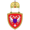
| Flag | Coat of arms |
|---|---|
 |

|
| Motto: Mana Qonqasunchikchutaq
"Nevertheless, we will not forget" | |
| Anthem: The War Song | |
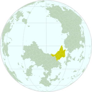
| Locator map | |
 | |
| Capital city | Qheca |
| Largest city | Viracachá |
| Official language | Remana |
| Other languages | Wariano, Aruxa, Auresian, Livaryan, Bahaso Sokoku |
| Ethnic groups | Ruma, Waria |
| Religion | Circulism |
| Demonym(s) | Chaskan |
| Government | |
| Government Type | Government type |
| Your 1st leader title (e.g. King) | name |
| Uma Akllaxqa (Premier) | Yunkar Munawasi |
| Legislature | your choice |
| Establishment | |
| The Founding of Qheca | date 1 |
| The Quiet Revolution | date 2 |
| Area | |
| Total | 1,983,088.96 km2 |
| Water % | 0.0% |
| Population | |
| Total | 85,219,877 |
| Density | 42.97/km2 |
| Economy | |
| Economy type | |
| GDP (total) | Ꞡ 525,506,341,492.37 |
| GDP per capita | Ꞡ 6,166.48 |
| Currency | samp_nat_currency |
| Currency symbol | |
| Inequality index | 0.0 |
| Development index | 0.0 |
| Other information | |
| Time zone | 0 |
| Driving side | right |
| Calling code | +441 |
| Internet code | .ch |
Chaska is a reasonably large, reasonably populated nation just to the south of the equator. It is most prominently known for its history (once part of three separate empires simultaneously), its reserves of gold and coal and plantations of coffee, its architecture, and its music.
Chaska used to be the eastern provinces of Huilcasonco, an empire spanning the Kancha and Suyana Mountain ranges and much of their associated lowlands on either side. Once divided, it then survived in the form of Ayawantin, an independent state in the southern lowlands which expanded out to the islands in the east while the mountains became the territory of colonial states. It was only after the Quiet Revolution that the two were reunited once again into the state occupying its present borders, although they were obliged to forfeit the island territory they had since gained.
Today, Chaska is divided into the northern regions—industrial, more than slightly Livaryan in look and manner, whose wealth comes from the provision of power through thermal generators on the mountain coastline—and the southern regions—less industrialized and more traditionalist (they call themselves ñach'uq "authentic, pure"), whose main wealth comes from trade and the plantations of coffee and spices found in the lowlands.
Etymology
Chaska as a name is a derivation (or perhaps acts a source for a derivation) of the word Chaskar, the Remana name for the planet Samler. Its bright white-blue light, appearing at morning or evening as "a grain of sky against the sunset", has made it an important star for the Ruma people and their neighbours for millennia, even forming the basis of a number of calendrical systems.
History
Chaskan history is often likened to Ruma history; many historians consider them one and the same, and the rest of the country's peoples mere afterthoughts. In fact, the Ruma and their Azix relatives are relative newcomers to the content, which had been inhabited for thousands of years prior to their crossing in from the northeast.
Geography
Demographics
Because of the nature of the settlement patterns in Ayawantin of old, there is a fairly strong divide between the "urban" and "rural" populations. The former are clustered together in great cities in the mountains or the grasslands, the landscape shaped to fit as many people as comfortably as possible. The latter live effectively everywhere else—high in the hills, in the deep rainforest, on the coast of the sea. One goes from almost to many to practically no people very quickly indeed.
Most of the urban population speaks Remana, but there are those who also choose to learn Auresian, Livaryan, or Bahaso Sokoku, all for the sake of better international dealings in trade or politics.